Skip Interest Selector

Show All 

Ancient Drawings of the Holy City
Print Bookmark
Ancient Drawings of the Holy City

Throughout its long history, the Holy City has always captured the hearts of scholars, researchers, and Christian pilgrims…

Throughout its long history, the Holy City has always captured the hearts of scholars, researchers, and Christian pilgrims. While they may not have known much about Jerusalem’s geography, that didn’t stop them from making maps. One curator, Dr. Milka Levy-Rubin, a staff member at the National Library of Israel, put together a collection of the city’s most ancient maps, showing us the many ways the Holy City has been drawn.

Jerusalem’s centrality in Christianity is immense, according to Dr. Levy-Rubin, particularly in light of the accounts of the last week in Jesus’ life, which all happened in different places across the city. “Jerusalem is the stage of the most important occurrence in Christianity, and this pinnacle is something every good Christian would like to imagine. This is where the maps come in.”

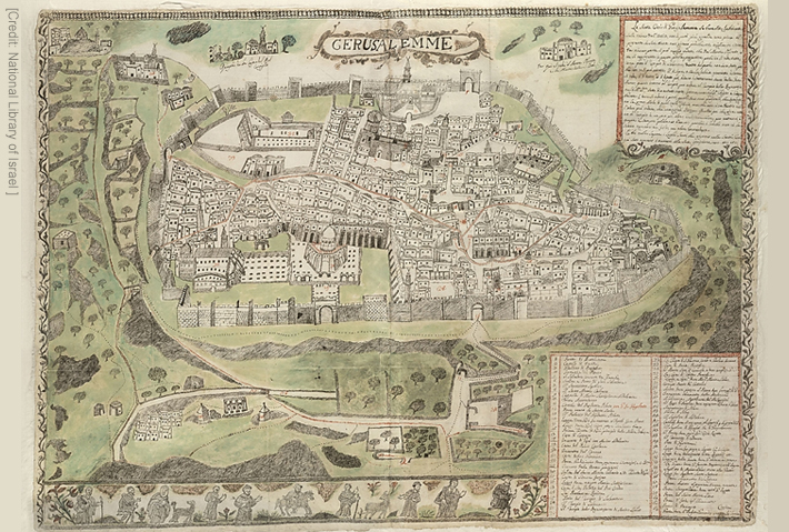
The “monk’s map,” a drawing from circa 1590, is the first map presented by Levy-Rubin and is considered one of the most ancient maps in the library’s collections. Although its illustrator remained anonymous, researchers believe he was a Franciscan monk who lived in Jerusalem.

Continue Reading…

IFCJ News

Throughout its long history, the Holy City has always captured the hearts of scholars, researchers, and Christian pilgrims…


We use cookies, including third-party cookies, to improve your experience on our site and to show you relevant advertising. Visit our Privacy Policy to learn more. By continuing to use our site you agree to our use of cookies.

Accept Cookies

close